Extraction of ECMWF data for the
trajectory model FLEXTRA
and the particle dispersion model FLEXPART
NEW UPDATE
If you need input data for FLEXTRA only, you can leave
away step 1
Warning: In order to use these routines, it is necessary
to have a user account on ecgate1.ecmwf.int
For more information: send
email to Paul James
The tar file ecdocs.tar
All routines and documentation needed are enclosed in the file ecdocs.tar:
Step 1: Retrieval and de-accumulation of flux data
The programs can be found in the directory ./fluxjobs_gen and
./fluxjobs_era (for ERA-15 data) .
The following flux data needed by FLEXPART are retrieved on a user-selectable
geographical grid (lamda-phi):
| Abreviation |
Full name |
Unit |
Field code |
| LSP |
Large Scale Precipitation |
mm/hr |
142 |
| CP |
Convective Precipitation |
mm/hr |
143 |
| SSHF |
Surf. Sens. Heat Flux |
W/m2 |
146 |
| EWSS |
East-West Surf. Stress |
N/m2 |
180 |
| NSSS |
North-South Surf. Stress |
N/m2 |
181 |
| SSR |
Surf. Solar Radiation |
W/m2 |
176 |
Flux data are not available in the ECMWF analyses, but they can be obtained
(in accumulated form) from the ECMWF short-term forecasts (first guess)
stored in three-hourly intervals (see ECMWF MARS database manual).
For de-accumulation, the following strategy is followed:
-
Precipitation (LSP, CP)
-
Accumulated values for 3/6/9/... UTC are just divided by the number of
hours, namely 3
-
Therefore, Precipitation at X UTC means: Mean precipitation per hour from
X-3 to X UTC
-
Other flux quantities
-
Accumulated values are not only divided by the number of hours, but also
interpolated to 3/6/9... UTC (for a three-hourly first guess with evaluation
time X UTC, a flux value has been accumulated from X-3 UTC to X UTC and
is therefore valid for X-1.5 UTC)
-
Therefore, e.g., Radiation (X UTC) means: Radiation valid for X UTC (three-hourly
average)
If you want to work with these routines, you should read the following
instructions:
-
Create a scratch-directory to save your flux data
-
e.g. mkdir $SCRATCH/flux
-
or for ERA-15 data mkdir $SCRATCH/flux_era
-
After each modification of the grid:
-
Modify the FORTRAN include file parameter according to
your new grid specifications
-
nx, ny: number of grid points
-
xlon0, ylat0: longitude and latitude of lower left grid point
-
dx, dy: grid distance
-
Compile and link de-accumulation routines (program FLUXACC)
-
f77 *.f $EMOSLIB
-
mv a.out FLUXACC
-
Retrieve the accumulated flux data from the MARS archive in batch mode
(surfjob.new)
-
Only first time: Modify the last line of surfjob.new according to your
own ecfile structure created
-
e.g.: ecp -o surf_* ec:/uid/metdat
-
Modify beginning and ending day
-
e.g. DAY=19970526/to/19970528
-
In the given example, the following data will be retrieved: 26 May 1997
03 UTC to 28 May 1997 18 UTC
-
Put your job in batch queue
-
e.g.: qsub -q ecgate1.normal surfjob.new
-
You will be notified via e-mail if your job starts and after it is finished
-
Look at the job log file in ~uid/waitqueue named SURFdataXXXXXX
with XXXXXX being a system-generated number
-
Deaccumulation of flux data, storage of results in ecfile system
-
For that purpose, use the script deacc.flux (interactive execution)
-
Modify deacc.flux before first usage:
-
Enter ecfile directory where the input to FLUXACC is stored (see
file surfjob.new).
-
Enter scratch directory where the output of FLUXACC shall be stored.
-
After succesful execution of deacc.flux, the data will be available in
the selected scratch directory in three (six for ERA data) hourly intervals.
The input to FLUXACC is deleted. The filenames are fluxYYYYMMDDHH
with YYYYMMDDHH being the date. These data are used in step 2
of the data retrieval procedure for FLEXTRA/FLEXPART
In the tar-archive, working samples of surfjob.new and deacc.flux
are available.
Step 2: Retrieval of other meteorological fields, calculation
of the vertical velocity component d(eta)/dt
The programs can be found in the directories ./job_era
./job_pre99 ./job_y2k
This step has been fully automated. The user just has to fill in a CONTROL
file, providing information like beginning date, ending date, time interval,
number of levels to extract, scratch directory for (optional) flux data
input, ecfile directory for output. Afterwards, the execution of a.out
creates a batch script and sends it to batch queue ecgate1.normal.
The batch file is saved under /tmp/job.prepo.bak.uid. After
execution, a job log file in ~uid/waitqueue named METEprepXXXXXX
with XXXXXX being a system-generated, unique number, is created.
Beginning and end of execution are anounced to the user via e-mail.
The batch-job works as follows:
-
It creates an executable CONVERT_PRE from source-files made available
(you do not need to have them in your own directories, and they are therefore
not included in the tar file)
-
It extracts ECMWF model data (U, V, T, Q, LNSP, ...) from the MARS archive
-
If available, it extracts your prepared flux data from the specified scratch
directory
-
It executes the routine CONVERT_PRE, which serves the folowing
purposes:
-
It reads in all ECMWF model data
-
It calculates gridded values of the vertical velocity component in the
ECMWF eta vertical coordinate system (d(eta)/dt) applying the equation
of continuity, making the wind fields 3D mass consistent.
-
It writes out all meteorological data including d(eta)/dt
-
It saves the resulting output files in the user-specified ecfile directory.
The files are ECMWF grib format (for grib decoding routines, ask ECMWF
user supports or people from your national weather service). The files
are named ENYYMMDDHH.
To use these routines, please follow the instructions step by step:
-
Before first execution, create an ecfile directory for your output
-
e.g.: emkdir ec:/uid/metdat
-
Fill in the file CONTROL
-
execute a.out
-
After the batch job has finished, have a look at your log file
-
At last, you can transfer the data to your local machine. Please mind
that transfer of grib encoded files via ftp requires the option binary.
Otherwise, the files get corrupt and have to be transfered again.
Technical comments:
-
The routine has been tested for many grid domains in the northern hemisphere.
It can also be used to retrieve hemispheric and global data.
-
The following important restrictions concerning the selection of
the grid domain do apply:
-
Specify domain boundaries only as whole numbers (e.g. -5.0
; Never: -5.5).
-
If the upper right boundary longitude is a positive number, the lower left
boundary longitude has to be negative.
-
For technical reasons, you can only chose grid configurations with dx=dy.
-
Please mind that d(eta)/dt can not be calculated for the Poles. It is set
to the values from the previous latitude.
-
This routine should work for all dates from 4 April 1995 onwards (ERA-15
version also from 1979 onwards). Please modify the spectral truncation
and the maximum number of layers in the CONTROL file according
to the information provided there (or have a closer look into your MARS
manual).
-
You can (and should) select a lower spectral truncation than possible in
the CONTROL file if you retrieve data on a coarser grid. Please
look at the comments in the CONTROL file concerning the relationship
between grid resolution and truncation.
-
Please mind: If you change the grid domain in job_xxx, and if
you need flux data, you have to retrieve new flux data for the modified
domain.
-
If you retrieve long periods at once (more than a month), check the status
of your job at times. If it has, e.g., produced no output for more than
24 hours, you should terminate it (command qdel) and start it
again for the time period not yet finished.
Update August 1998 - Retrieval of additional parameters, 3 prepared domains
In August 1998, the retrieval routines (Step 2) were revised to get additional
quantities potentially useful for particle modelling, air quality modelling
and mesoscale meteorological modelling. The following additional data are
now provided:
| Abreviation |
Field code |
Name |
| SDOR |
160 |
Std. Deviaton of Orography |
| VEG |
199 |
Percentage of vegetation |
| SR |
173 |
Surface roughness |
| LCC |
186 |
Low cloud cover |
| MCC |
187 |
Medium cloud cover |
| HCC |
188 |
High cloud cover |
| SKT |
235 |
Skin temperature |
| STL1 |
139 |
Soil temperature level 1 |
| SWL1 |
140 |
Soil wetness level 1 |
Please notice: The new routines just work for ECMWF data from
04/04/1995 0 UTC onwards. If you want to extract older ECMWF data, use
older routines written by Gerhard Wotawa.
If you want to use these old routines, just
download them.
Handling of wind components at the poles
At the south Pole (phi=-90 DEG) and the north Pole (phi=90 DEG), all scalar
quantities (e.g., temperature) are set to the same value for -178<=
lambda <= 180 DEG (i=1,NX) on the lambda-phi grid. The wind components
u, v are handled according to the following convention:
North Pole:
u(lambda)=-ff sin(lambda+dd)
v(lambda)=-ff cos(lambda+dd)
where lambda are the geographical longitude (-pi to + pi), ff the wind
speed at the pole, dd the wind direction at the pole. Both, ff and dd,
are constant for the Pole.
The wind direction is calculated as follows:
dd(lambda)=atan(u(lambda)/v(lambda))-lambda [if v(lambda)<0]
dd(lambda)=pi+atan(u(lambda)/v(lambda))-lambda [else]
For example: A wind direction of pi (180 DEG) means that the wind at
the pole blows along the Greenwich meridian towards the pole. If the wind
direction is 0, the wind blows the other way round.
South Pole:
u(lambda)=+ff sin(lambda-dd)
v(lambda)=-ff cos(lambda-dd)
The wind direction is calculated as follows:
dd(lambda)=atan(u(lambda)/v(lambda))+lambda [if v(lambda)<0]
dd(lambda)=pi+atan(u(lambda)/v(lambda))+lambda [else]
For a better understandig, I provide a little program where wind at
the south and north pole is transformed to speed and direction and subsequently
transformed back according to the pole convention used by ECMWF:
* SOUTH POLE

      DO 666 I=1,NX
         LLON=-178+FLOAT(I-1)*DX
         LLON1=LLON*PI/180.
         WSPEED=SQRT((U3D(I,1,1)**2)+(V3D(I,1,1)**2))
         IF(V3D(I,1,1).lt.0.) THEN
           DDPOL=ATAN(U3D(I,1,1)/V3D(I,1,1))+LLON1
         ELSE
           DDPOL=PI+ATAN(U3D(I,1,1)/V3D(I,1,1))+LLON1
         ENDIF
         IF(DDPOL.LT.0.) DDPOL=2.0*pi+DDPOL
         IF(DDPOL.GT.2.0*PI) DDPOL=DDPOL-2.0*pi
         UNEW=+WSPEED*SIN(LLON1-DDPOL)
         VNEW=-WSPEED*COS(LLON1-DDPOL)
666      WRITE(999,778) I,LLON,U3D(I,1,1),V3D(I,1,1),WSPEED,
     &         UNEW,VNEW

*NORTH POLE

            DO 777 I=1,NX
         LLON=-178+FLOAT(I-1)*DX
         LLON1=LLON*PI/180.
         WSPEED=SQRT((U3D(I,NY,1)**2)+(V3D(I,NY,1)**2))
         IF(V3D(I,NY,1).lt.0.) THEN
           DDPOL=ATAN(U3D(I,NY,1)/V3D(I,NY,1))-LLON1
         ELSE
           DDPOL=PI+ATAN(U3D(I,NY,1)/V3D(I,NY,1))-LLON1
         ENDIF
         IF(DDPOL.LT.0.) DDPOL=2.0*pi+DDPOL
         IF(DDPOL.GT.2.0*PI) DDPOL=DDPOL-2.0*pi
         UNEW=-WSPEED*SIN(LLON1+DDPOL)
         VNEW=-WSPEED*COS(LLON1+DDPOL)
777      WRITE(999,778) I,LLON,U3D(I,NY,1),V3D(I,NY,1),WSPEED,
     &         UNEW,VNEW
778      FORMAT(i3,1x,f5.0,1x,5f7.2)
Important remark: A spectral truncation of T106 is default
in the ECMWF mars system for the retrieval of 2x2 DEG lambda-phi data out
of the Sperical Harmonics (SH) data. However, as I have tested, this truncation
is insufficient to obtain accurate wind data at the poles. If you
use the latest (6.1.1999) version of my routines, this problem is fixed.
If not, make sure that U,V wind components are retrieved at least with
T213 or T319. This problem is serious. Wind data at the poles are definitely
unusable with the lower truncation.
Bug reports:
(1) Date: 12.1.1999
Modification: File makeinclude.f in directory job.tra1995+ modified
Please note: Values of etapoint and log surface pressure are wrong in the
global 2x2 grid as well as in the 0.4 degrees grid prior to this modification.
Restrictions
This software can be used "as is" by all people having user accounts at
the ECMWF workstation ecgate1.ecmwf.int, without any fee or cost. Any warranty
is disclaimed and no support is given. This software is part of the FLEXTRA
and FLEXPART program package. The same regulations as accepted by using
FLEXTRA and FLEXPART do apply. Please keep in mind the data usage regulations
of the European Centre for Medium Range Weather Forecasts and of your national
weather service. Any use of this program, which is against these regulations,
is prohibited.
You are kindly invited to report problems and bugs to
me.
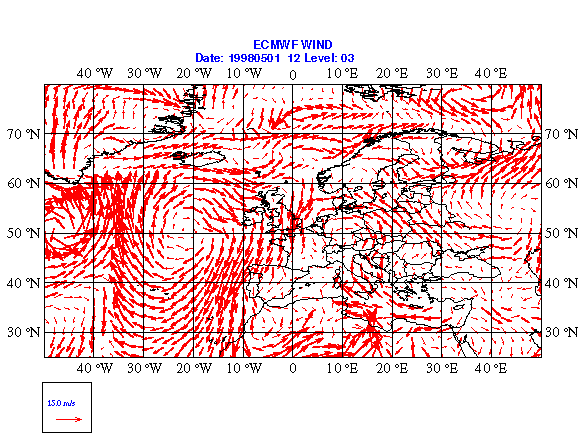
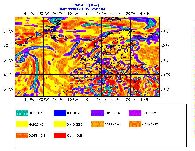
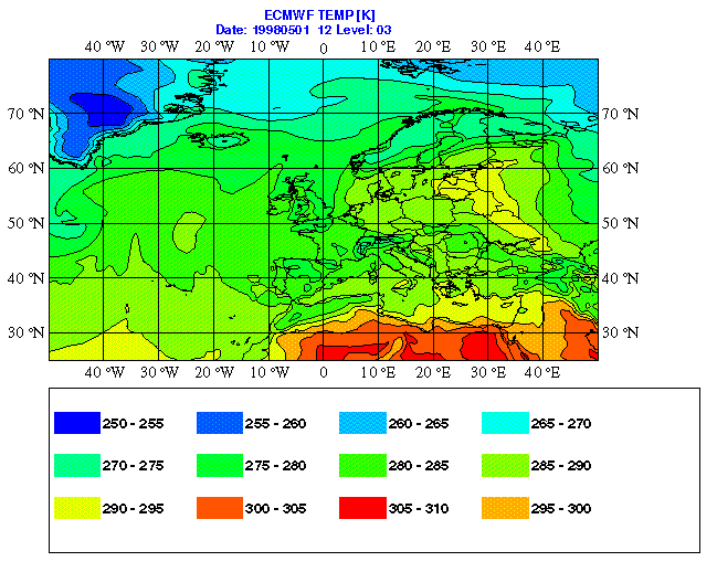
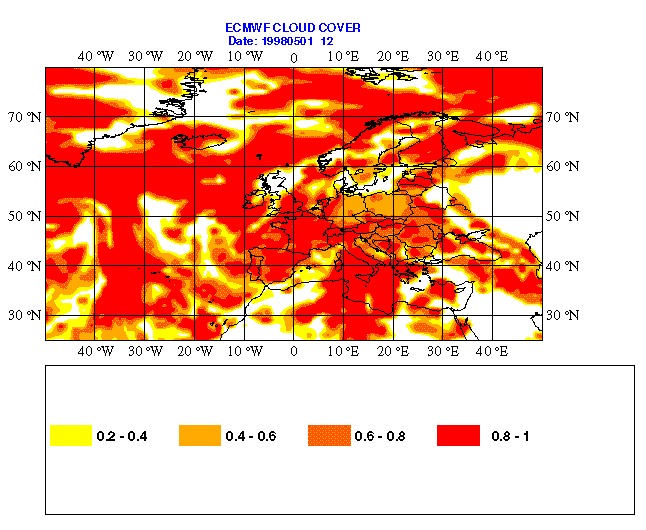
Appendix: Plot of sample fields


Last update: 7 August 2000 by Paul James


