|
|
|
|
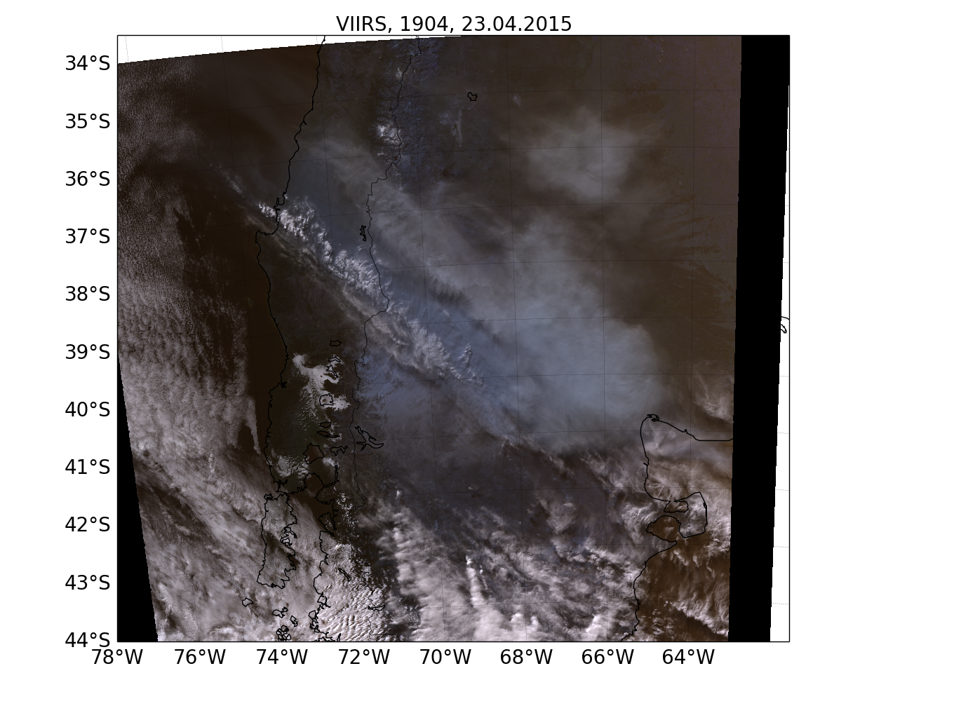
Calbuco April 2015 eruption as seen by VIIRS
The Calbuco volcano erupted on April 22, 2015. Below is shown an RGB composite generated from the M3, M4 and M5 channels of the Visible Infrared Imaging Radiometer Suite (VIIRS) onboard Suomi NPP. The ash and SO2 from the eruption is seen as a bluish/grey cloud different from the other clouds visible in the image.
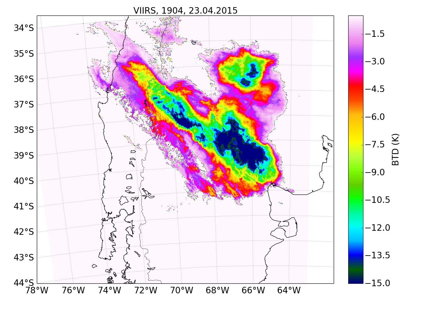
The brightness temperature difference (BTD) between the VIIRS M15 and M16
channels may be used to detect pixels affected by ash. For ash
affected pixels the BTD will be negative as shown in the figure below.
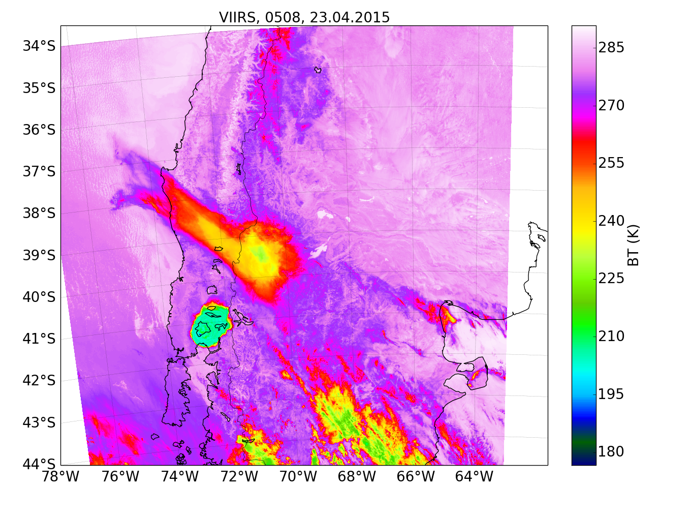
An interesting case was observed earlier in the day (night). The below image shows the M15 brightness temperature at about 05:08 UTC. The dense ash cloud above the volcano is readily seen around 41.32S, 72.5W. See also images at the CIMSS Satellite Blog.
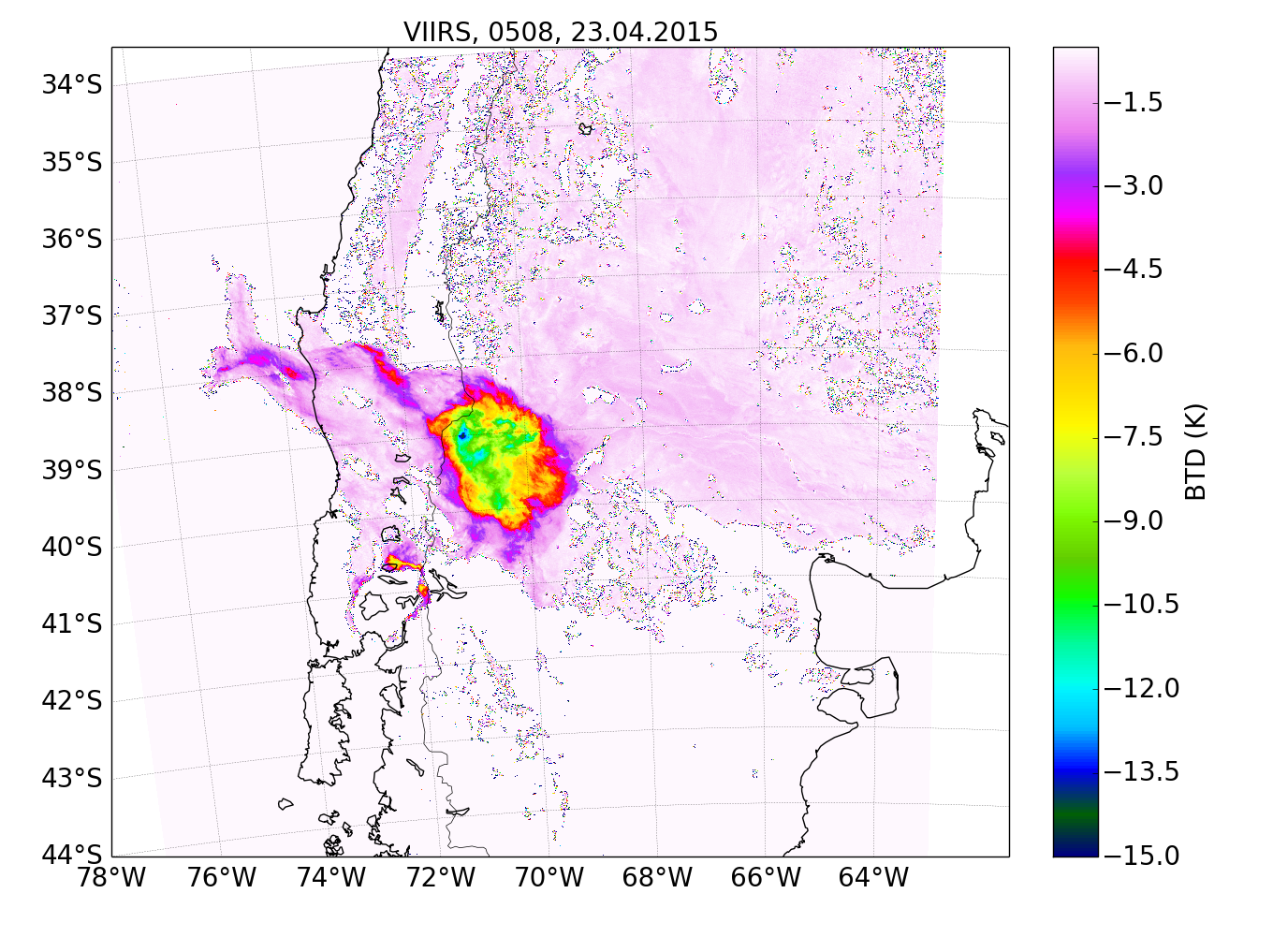
The BTD for the above scene is shown in the Figure below. Interestingly the ash above the volcano is not seen in the BTD. This is due to the opaqueness of the ash cloud above the vent. When the ash cloud is dispersed it gets optically thinner and visible in the BTD. A dispersed, and thus thinned, ash cloud from the first phase of the eruption is seen north-northeast of the volcano.
Data obtained from NOAA.
|
|